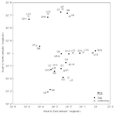
The study was conducted in south-eastern Peru, at the Cocha Cashu Biological Station EBCC in the Manu National Park (11°51 ′ 23 ″ S 71°43 ′ 17 ″ W). With over 2 million hectare, Manu is one of few sites around the world where diverse assemblages of plants and animals remain intact and accessible for study. The average annual rainfall is about 2300 mm, with most precipitation falling between November and May. Mean annually temperatures ranges from 9°C to 34°C. The study area consists of approximately 10 km2 lowland tropical evergreen rainforest (Terborgh, 1990).
We selected 15 gaps according to a gradient of size, from ~100 m2 up to ~1000 m2, with a minimum distance of 100 m between them. An additional of 15 undisturbed understory control sites were chosen by taking a random direction from the center of a gap, and they were placed at a >50 m from the center of the gap. If the understory site encountered another gap, another random direction was chosen.
Responsible for this page:
Director of undergraduate studies Biology
Last updated:
06/15/10
